I may be late to the party on this particular trick but until this past weekend I didn't realize you could get building-to-building directions for our campus on Google Maps. They're not the most accurate because we don't have sidewalks listed on Google Maps yet (see further down for how we should address this) but something is better than nothing. I'm curious if this trick works for other campuses.
The Trick
To see if you can take advantage of this trick do the following:
- Zoom into your campus on Google Maps.
- Assuming your buildings are shown, use the names of two buildings as listed on Google Maps (this is important, they have to match exactly what's shown) and enter them as the start and end points for your directions.
- Click the person icon to make sure you get the walking directions.
- Click "Get Directions."
Now, fingers crossed, their should be walking directions between the two buildings you searched for. Important: This is not foolproof. We have a dorm listed as ‘Bennett' and Goole Maps won't provide directions since other places in town match the name first. It's really called ‘Bennett Tower' so hopefully we can get that updated.
Examples
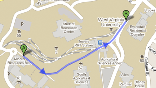
Here's an example of walking directions between our Mineral Resources Building and the Evansdale Residential Complex. It uses one of the few sidewalks we have listed.

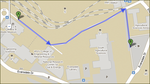
You can even use Google Maps to get directions from a building to a parking lot (and I assume vice versa).

It'd be great if Google Maps understood we were a campus and point driving directions to take visitors to a metered parking lot first and then walking directions from there to a campus building. Unfortunately, it doesn't look like that's supported. If anyone from Google reads this though… it'd be fantastic and really useful.
Adding Sidewalks with Google Map Maker
For the most part I'm sure the walking directions you'll get out of Google Maps will still follow the roads on campus. That's definitely not the best solution for your users. Well, enter in Google Map Maker for adding sidewalks and other campus map data to Google Maps. Google even highlights schools and universities as ideal users for their new service. Think of it as a map-based wiki. Essentially the service allows you to use your browser to submit changes and updates to Google Maps that can be reviewed and, hopefully, added. You can add sidewalks, roads, building footprints and points of interest (maybe that statue of your mascot?). You can also use it to edit information that is already found on the map like building names or, even, carpet area if you happen to have that info. Why a campus building would have a syllabus (another bit of data you can supply) is beyond me though…
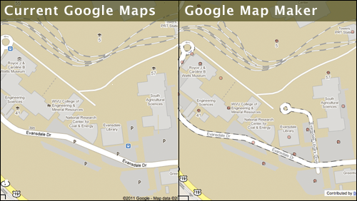
Their are already a few students and staff members obviously updating information around our campus. Note the addition of the campus road in the right-panel that's waiting for review.

More Work…
Yes, this brings a whole another layer for campus-related data to maintain and manage in a 3rd party tool. That being said, it might prove to be a good summer project for an intern to get all your information updated before school starts up again in the fall. From our experience, a campus map see a huge uptick in use at the beginning of the semester. I'm sure that use extends to Google Maps now that they've started listed campus buildings. And, hey, there's no reason why you can't use Google Maps for your mobile campus map ![]()
Hat tip to Steven Spriggs (@stevenspriggs) for the "wiki" description of Google Map Maker.
Update as of 9.15pm on May 23 (same day original article was posted): changes made to Google Maps this afternoon via Google Map Maker have already made their way to the regular version of Google Maps. It looks like name changes can happen very quickly.